Merida and Yucatan Maps
After many years of living on the planet, it's obvious to us that maps can both clarify and obfuscate. There's nothing more frustrating than an out of date map, but newcomers need them... we noticed when we first traveled here that we spent a lot of time with our maps. Now that we have lived here for a while, we use maps more as a "rule of thumb" when driving through the Yucatan countryside. The magic of traveling in the Yucatan is easier to find when the maps are left folded up in the back seat.
It used to be that there wasn't much in the way of maps here. When we left California to drive to the Yucatan (it took us ten days of driving from 8 am until dark), we took with us very detailed guides that had been given to us by the company that sold us Mexican car insurance. These guides laid out routes (Guanajuato to Mexico City, for instance, or San Miguel Allende to Puebla). And they told you every single turn you needed to make at every single tree or gas station. The guide told you where the signs were or were not. But while these guides were thorough, they were not always accurate because even then, things were changing rapidly.
When we finally arrived in Merida, we were given a large map with all the place names of every little pueblito in Yucatan. We were told this was a very precious document, and if we wanted another, we'd have to go to the INEGI office, something local Yucatecos seemed to know how to do but very few gringos had yet accomplished.
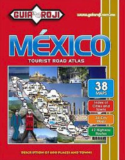
Then maps started showing up more often in the local Dante bookstores. Good maps, then better maps. We "discovered" the Guia Roji for driving anywhere in Mexico. Guia Roji is published yearly as an 8x10 book. It is only sold in Mexico, but it is sold in many places. We've seen them in Dante Bookstores, Sanborn's and WalMart. Guia Roji also has a comprehensive website, with both paper maps and maps on CD for sale. With the most recent Guia Roji, you can drive anywhere in Mexico with assurance. But don't think last year's Guia Roji will give you the same warm fuzzies. Mexican roads are being built at a rapid rate, and it helps to have the newest information. This is *especially* true in the Yucatan, where the local government has prided itself on the kilometers of new road it has laid down every year for the last few years, and has erected billboards to tell us about it.
When maps started showing up as useful tools on the Internet, those of us who lived here were disappointed to find that none of them included the Yucatan (or much of Mexico for that matter). It didn't surprise us and we wrote off the whole idea of Internet maps. When Google Earth was launched, Merida was a big white blur.
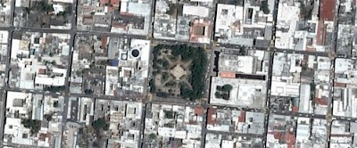
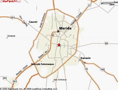
But in the last few years, Merida has started to show up very nicely, thank you very much. Google Earth now has high resolution photos with street overlays of Merida. And just like that out of the blue, MapQuest had all of Merida completely mapped! What a find! No longer does anyone have to rely on outdated maps of this area. We now have the same tools available to us as anyone in New York City or Paris.
So when it comes to the Internet, we can say Merida is finally on the map!




Comments
Joseph 19 years ago
Yeah, right... the Cessna at the city zoo. The problem is I can't get near it, since it always seems to be full of... kids.
Mmmm, fruitcake!
Reply
Working Gringos 19 years ago
Joseph... you know if you were in jail during Christmas, we'd bring you a fruitcake. But if you really can't resist sneaking around the "jungle" for hidden aircraft, you can always go here, like everyone else:
20° 58' 6.50" N
89° 38' 25.69" W
Reply
Andrea 19 years ago
We saw the google maps just before we made our journey to Merida. It was so cool to see the places on the ground, in person after we got there!
Reply
Joseph 19 years ago
And thanks to Google Earth, I've seen 10 abandoned airplanes in the "jungle" next to the Airport, probably taken away from drug lords :D
Looks like a DC-4, four DC-3s and three smaller planes.
20'55'39.82" N
89'39'39.18" W
Would be cool to sneak in and take a look, but the idea of spending Christmast in jail is not very appealing to me.
Reply
Khaki 19 years ago
I am looking at that map of Centro at 11:39 AM. It is time for lunch. You have a picture in which I can SEE my favorite cafe. I am starving for a club sandwich from La Via Olimpo Restaurant and Café - but I am in Hot Springs Village, Arkansas, and it snowed here last night. Love the maps - wish I hadn't read this until after lunch. :)
Reply
Working Gringos 19 years ago
Thanks Kenneth. There are about 140 articles on this website and they are all listed under their various "Topics" that you can access on the top-right side of each page.
Reply
Kenneth 19 years ago
Great resource. Is there a way to access past articles?
Reply
Debi 19 years ago
I love having all the different mapping resources for Merida. Now if we could only use mapquest to route the way from my house to yours... or the bank, or well just about anywhere. There is even a bus map; but it only works from Centro out - no return routes; life is nothing if not for the adventure.
Thanks for all the great articles!
Reply
« Back (10 to 18 comments)